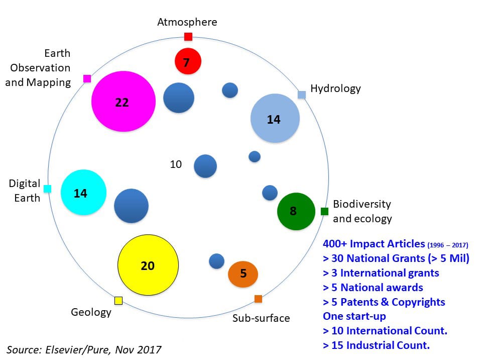
Niche Area
Research area of INSTeG
Introduction:
Our research encompasses a wide array of geospatial sciences, covering Spatial Modeling & Analytics, GeoSensing Big Data, Hyperspectral Remote Sensing, Geodesy, Remote Sensing for Environment, Ecology & Biodiversity, Marine Remote Sensing, Thermography & Utility Mapping, and Geospatial Hydrology. This comprehensive approach reflects our dedication to advancing understanding and application across diverse spatial domains.
Objectives:
Our overarching objectives include harnessing cutting-edge technologies to develop innovative solutions for complex spatial challenges. By synergistically combining spatial modeling, analytics, and the utilization of GeoSensing Big Data, we aim to derive actionable insights for a broad spectrum of applications, ranging from environmental monitoring to biodiversity conservation.
Methodology:
Our research methodology integrates advanced techniques such as Hyperspectral Remote Sensing, Geodesy, and Marine Remote Sensing. Leveraging these technologies, we seek to capture intricate spatial information, unraveling the nuances of ecosystems, landscapes, and hydrological systems. The application of Thermography and Utility Mapping further enhances our ability to map and analyze spatial features with precision.
Significance:
The significance of our research lies in its potential to contribute to environmental sustainability, biodiversity preservation, and informed decision-making. Our work in GeoSensing Big Data addresses the challenges of handling vast datasets, while the application of Hyperspectral Remote Sensing and Marine Remote Sensing offers a deeper understanding of complex environmental processes.
Current State of Knowledge:
In the current state of geospatial sciences, gaps persist in our understanding of intricate ecological dynamics and the sustainable management of resources. Our research aims to bridge these gaps by pushing the boundaries of knowledge and offering nuanced insights into the interplay of various spatial factors.
Expected Contributions:
We anticipate that our research will yield contributions in the form of refined spatial models, data analytics methodologies, and practical applications in fields such as environmental management, ecology, and hydrology. Advancing knowledge in Thermography, Utility Mapping, and other specialized areas aims to pave the way for more effective and sustainable spatial solutions.
Collaboration and Future Work:
Collaboration is fundamental to our approach. We invite researchers, practitioners, and stakeholders to join us in this interdisciplinary journey. Future work will explore the integration of emerging technologies, the expansion of our spatial analytics toolkit, and the development of holistic solutions to address the evolving challenges in our diverse research domains.
