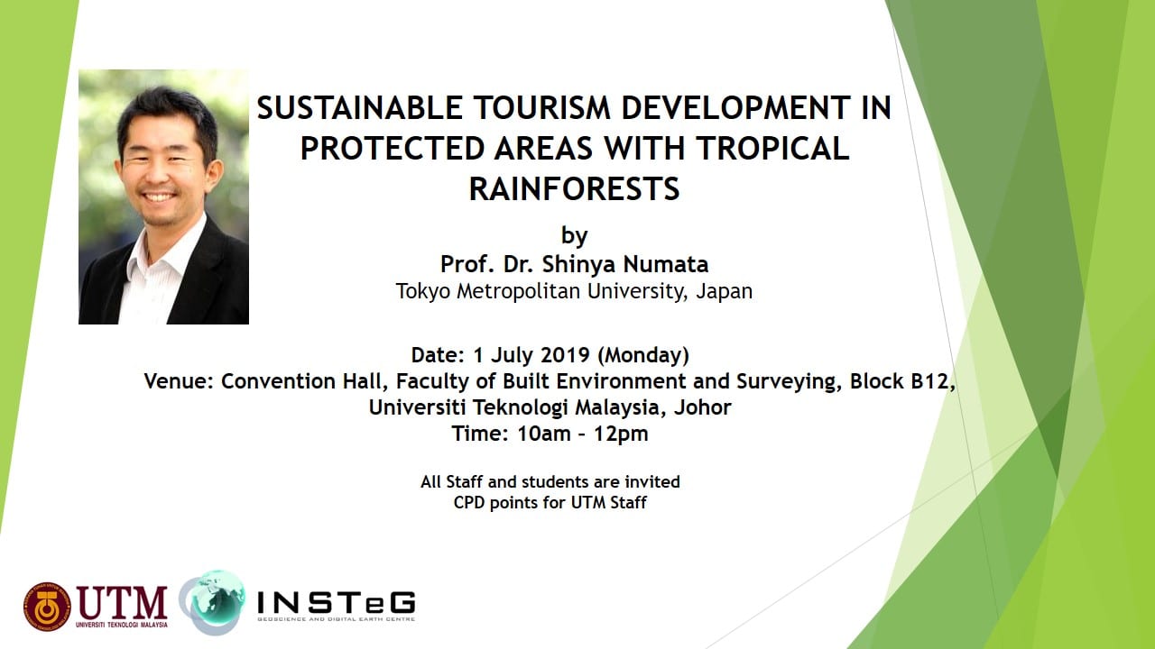
We are pleased to invite you to public lecture entitle ‘Sustainable Tourism Development in Protected Areas with Tropical Rainforests’ by Prof. Dr. Shinya Numata from Tokyo Metropolitan University, Japan.
Date: 1 July 2019 (Monday)
Time: 10:00 am – 12:00 pm
Vanue: Convention Hall, Faculty of Built Environment and Surveying, Blok B12, Universiti Teknologi Malaysia, Johor.
All UTM staff and students are invited. CPD points will be recorded for UTM staff.
Should you require further information about the public lecture, please feel free to contact us via email: insteg@utm.my
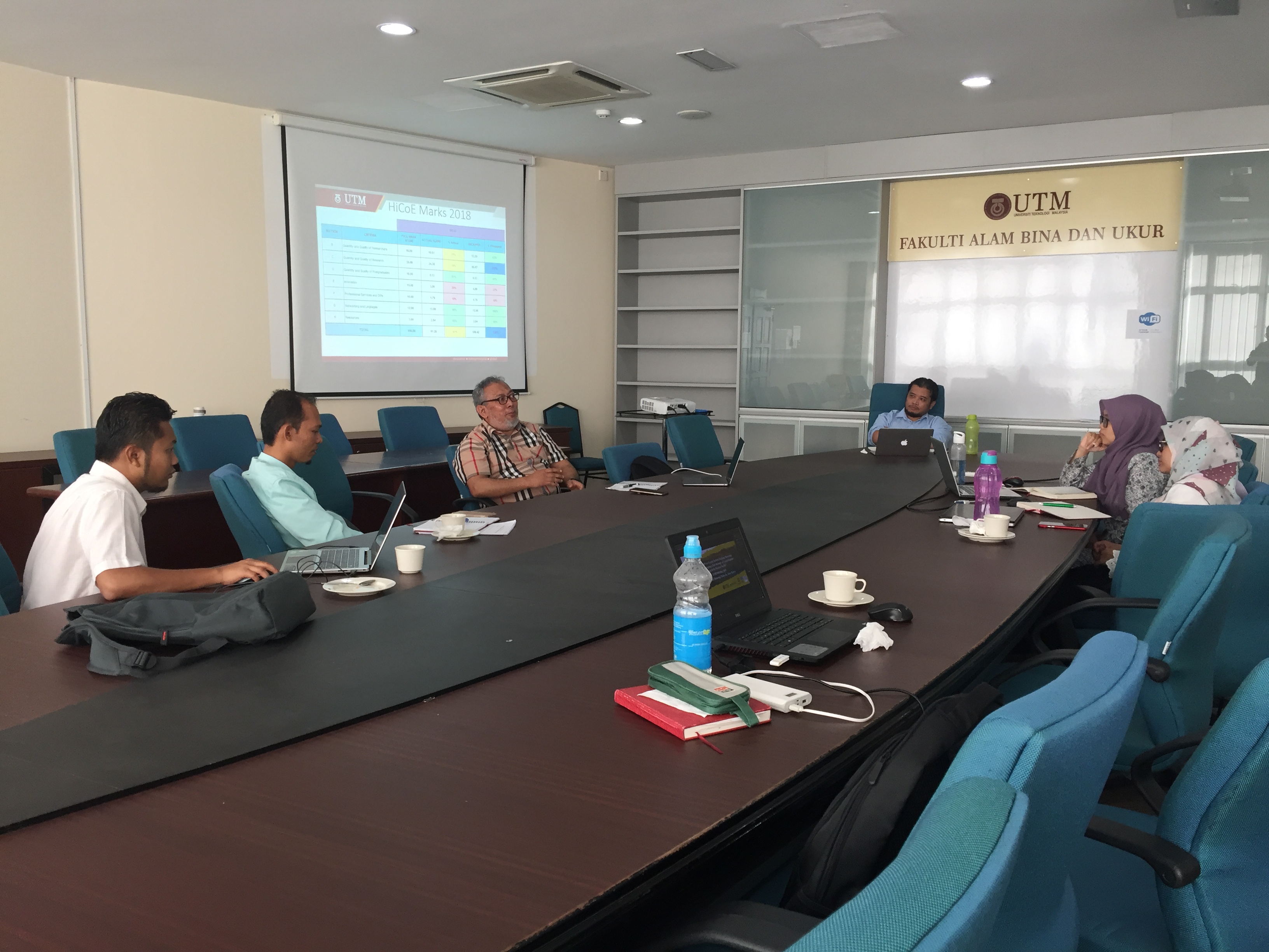
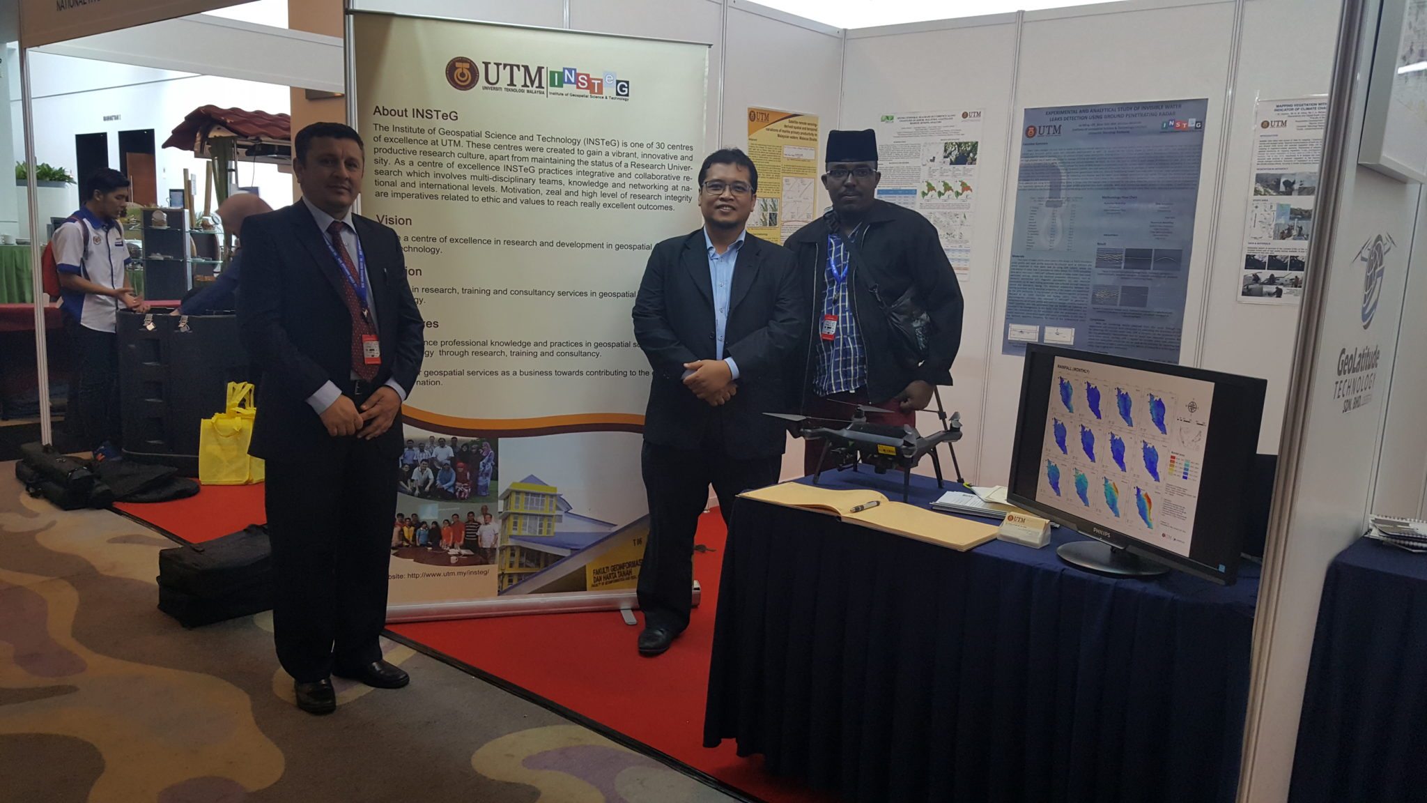
February 17, 2019, a strategic planning meeting was held at the Faculty of Build Environment and Surveying (FABU), Johor. This meeting aims to improve KPI INSTeG in 2019 and improve quality control. The meeting was attended by Prof Sr. Dr Mazlan Bin Hashim, Dr Nadzri Bin Md Reba, Dr Mohd Rizaludin Bin Mahmud, Dr Ami Hassan Bin Md Din, Dr Noordyana Binti Hassan, Pn. Nurul Nadiah Binti Yahya and Mr. Mohd Taufik Bin razali.
Remote sensing technology plays a vital role in the initial stages of ore mineral exploration. Increasing demands for minerals by society due to the exponential growth in population and industrialization emphasize the need for replenishing depleting reserves by locating new prospective ore deposits. In recent decades, hydrothermal alteration mineral detection has become one of the most conspicuous applications of multispectral and hyperspectral remote sensing satellite data for ore mineral exploration. Numerous ore deposits such as orogenic gold, porphyry copper, massive sulfide, epithermal gold, podiform chromite, uranium, magnetite and iron oxide copper-gold (IOCG) deposits have been successfully prospected and discovered using remote sensing satellite imagery in the metallogenic provinces and frontier areas around the world. The Advanced Spaceborne Thermal Emission and Reflection Radiometer (ASTER), Landsat data series, the Advanced Land Imager (ALI), Worldview-3, Hyperion, HyMap and the Airborne Visible/IR Image Spectrometer (AVIRIS) multispectral and hyperspectral data support cost-effective techniques for ore mineral exploration around the world. Advanced image processing algorithms based on state-of-the-art data extraction techniques can be implemented for detecting key alteration minerals associated with a variety of ore deposits. Analytical spectral device (ASD) spectroscopy and X-ray diffraction (XRD) analysis in conjunction with remote sensing data can provide comprehensive information about the alteration zones and mineral assemblages associated with ore mineralizations. Synthetic Aperture Radar (SAR) data contain a high potential for structural analysis and mapping in metallogenic provinces. On the other hand, human-induced change in the form of mine excavation, mine tailing, mine waste and acid runoff requires particular monitoring by remote sensing satellite data. Environmental pollution mapping and monitoring of mined areas are the main challenges that need to be addressed for future sustainability and environmental management in metallogenic provinces.
The topics of interest include, but are not limited to:
Hydrothermal alteration mineral mapping
Porphyry copper prospecting
Reflectance and emission spectroscopy of phyllosilicates
Geothermal potential mapping
Spectral mapping alghorithm analysis and development
New pixel- and sub-pixel-based image analysis techniques
Environmental monitoring of mined areas
Detecting toxic pollution related to mine excavation, mine tailing, mine waste and acid runoff
Recent advances in remote sensing information fusion for mineral exploration
Real-world case studies of mineral prospecting in inaccessible regions using remote sensing data
Geological mapping and mineral exploration in Antarctica and the Artic
Hyperspectral data analysis for mineral detection
GIS and remote sensing integration for mineral exploration modeling
Integration of multispectral and hyperspectral data for mineral mapping
Application of SAR data for structural mapping in metallogenic provinces
Raman spectroscopy for mineral detection
Characterization of recently-launched satellite sensors for mineral detection
Interpretation of ASD spectroscopy and XRD analysis for mineral exploration
Regional lithological and geological mapping using satellite remote sensing data
Listvenite mapping in orogenic systems
Reflectance spectroscopy of rocks and minerals
Mineral mapping using airborne hyperspectral data
Application of automatic target detection algorithms for hyperspectral imagery
Dr. Amin Beiranvand Pour
Prof. Dr. Basem Zoheir
Prof. Dr. Biswajeet Pradhan
Prof. Dr. Mazlan Hashim
Guest Editors
Manuscript Submission Information
Manuscripts should be submitted online at www.mdpi.com by registering and logging in to this website. Once you are registered, click here to go to the submission form. Manuscripts can be submitted until the deadline. All papers will be peer-reviewed. Accepted papers will be published continuously in the journal (as soon as accepted) and will be listed together on the special issue website. Research articles, review articles as well as short communications are invited. For planned papers, a title and short abstract (about 100 words) can be sent to the Editorial Office for announcement on this website.
Submitted manuscripts should not have been published previously, nor be under consideration for publication elsewhere (except conference proceedings papers). All manuscripts are thoroughly refereed through a single-blind peer-review process. A guide for authors and other relevant information for submission of manuscripts is available on the Instructions for Authors page. Remote Sensing is an international peer-reviewed open access bimonthly journal published by MDPI.
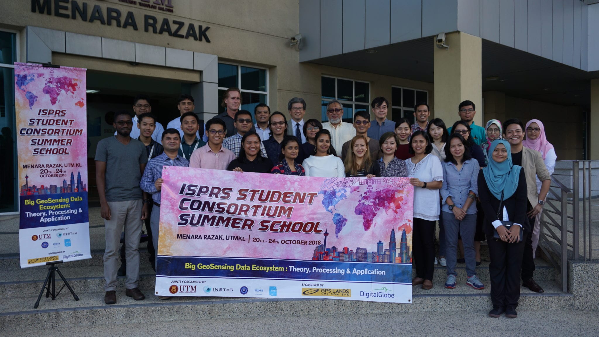
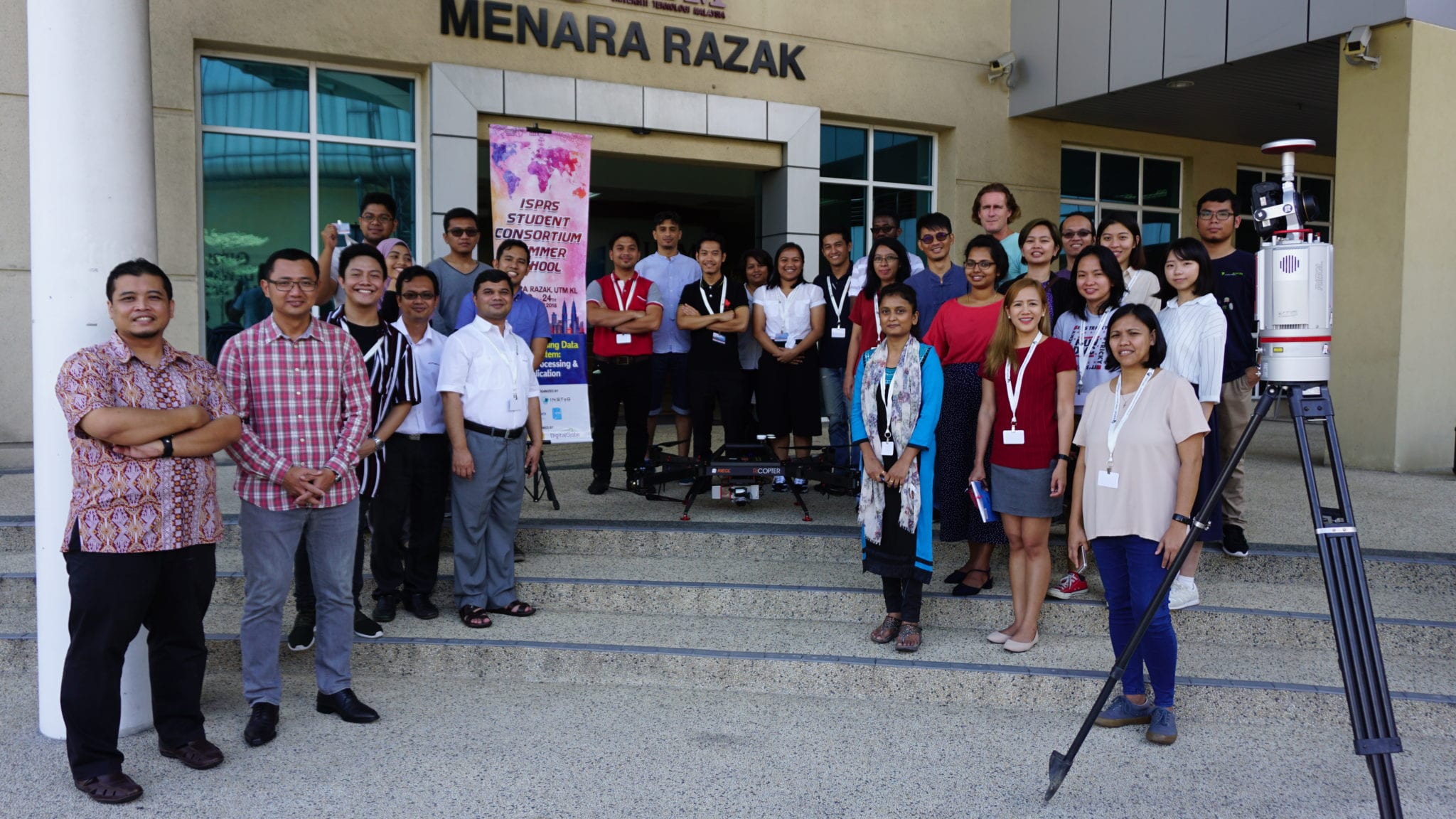
KUALA LUMPUR, 24 Oct. – Geoscience and Digital Earth Centre (INSTeG), Research Institute for Sustainability and Environment (RISE), Universiti Teknologi Malaysia (UTM) in collaboration with International Society of Photogrammetry and Remote Sensing Student Consortium (ISPRS SC) organized the ISPRS SC Summer School in conjunction with the 39th Asian Conference on Remote Sensing (ACRS 2018) in Kuala Lumpur. The summer school was held at Menara Razak of UTM Kuala Lumpur campus from October 20th to 24th, 2018 with the theme of “Big GeoSensing Data Ecosystem: Theory, Processing & Application”. The Asian Association on Remote Sensing (AARS) General Secretary, Prof. Kohei Cho was attended to officiate and warmly greet the participants from the Philippines, Thailand, Indonesia, India, Taiwan, Uganda, Pakistan, Libya and Malaysia. They are students and lecturers from universities and officers from agencies and industries.
Group photo of all participants, speakers, and secretariat right after the opening ceremony.
This international event aims to provide an opportunity for students and young researchers to get into lectures from various eminent experts within the field of remote sensing, photogrammetry and geospatial information sciences. Participants are expected to gain knowledge from a series of lecture, practical sessions and excursion at a minimum cost. Besides that, it is an international platform of collaboration among students, young researchers, experts and the industry to provide a bigger perspective of the profession as well as to establish relationships within the scientific community and the industry.
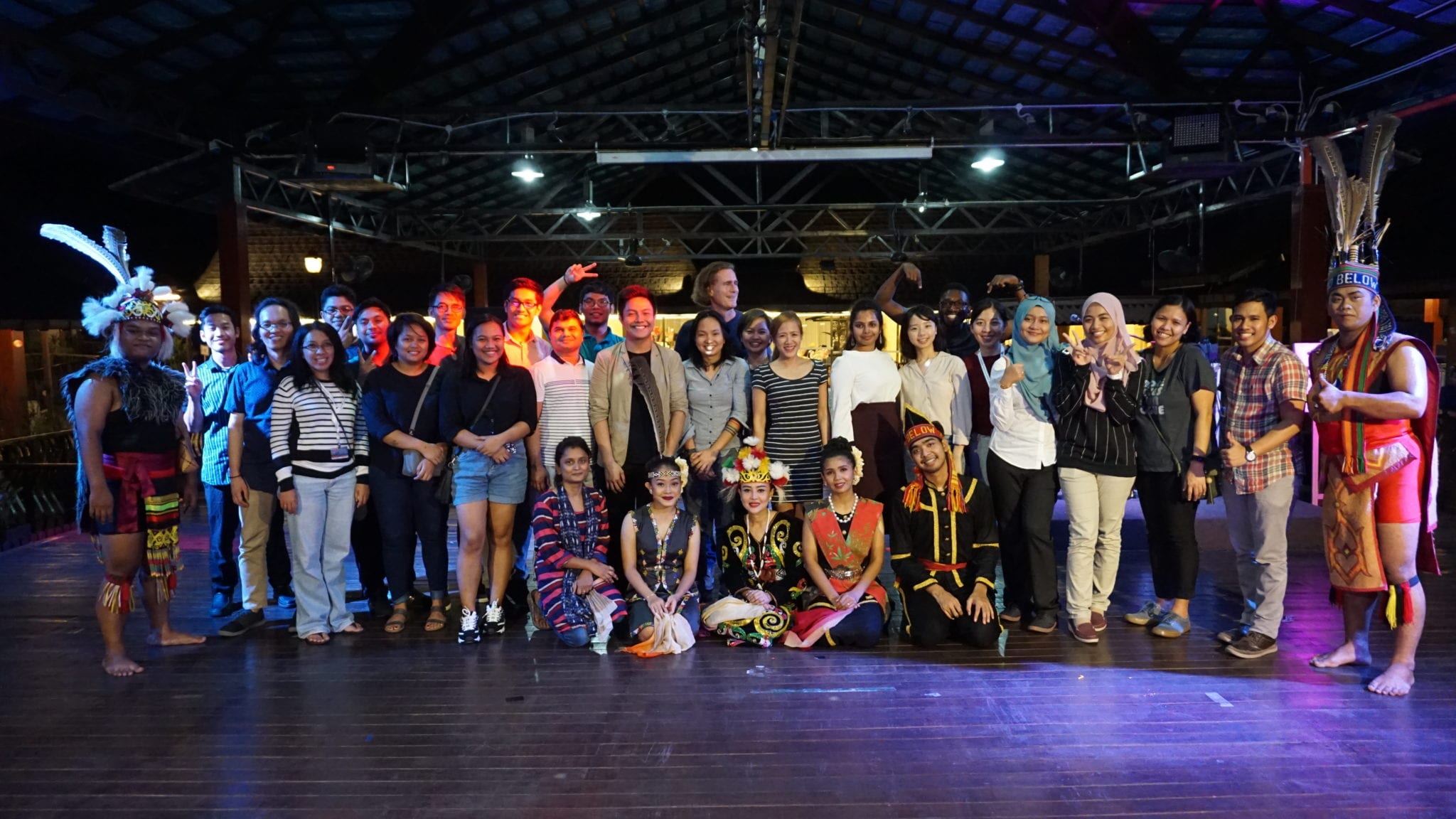
Welcoming dinner at D’Saji KL, Titiwangsa
Lectures on the topic related to big geosensing data ecosystem were delivered by prominent professors and extra in the field and were accompanied by practical sessions.
Practical session from industry using terrestrial laser scanning.
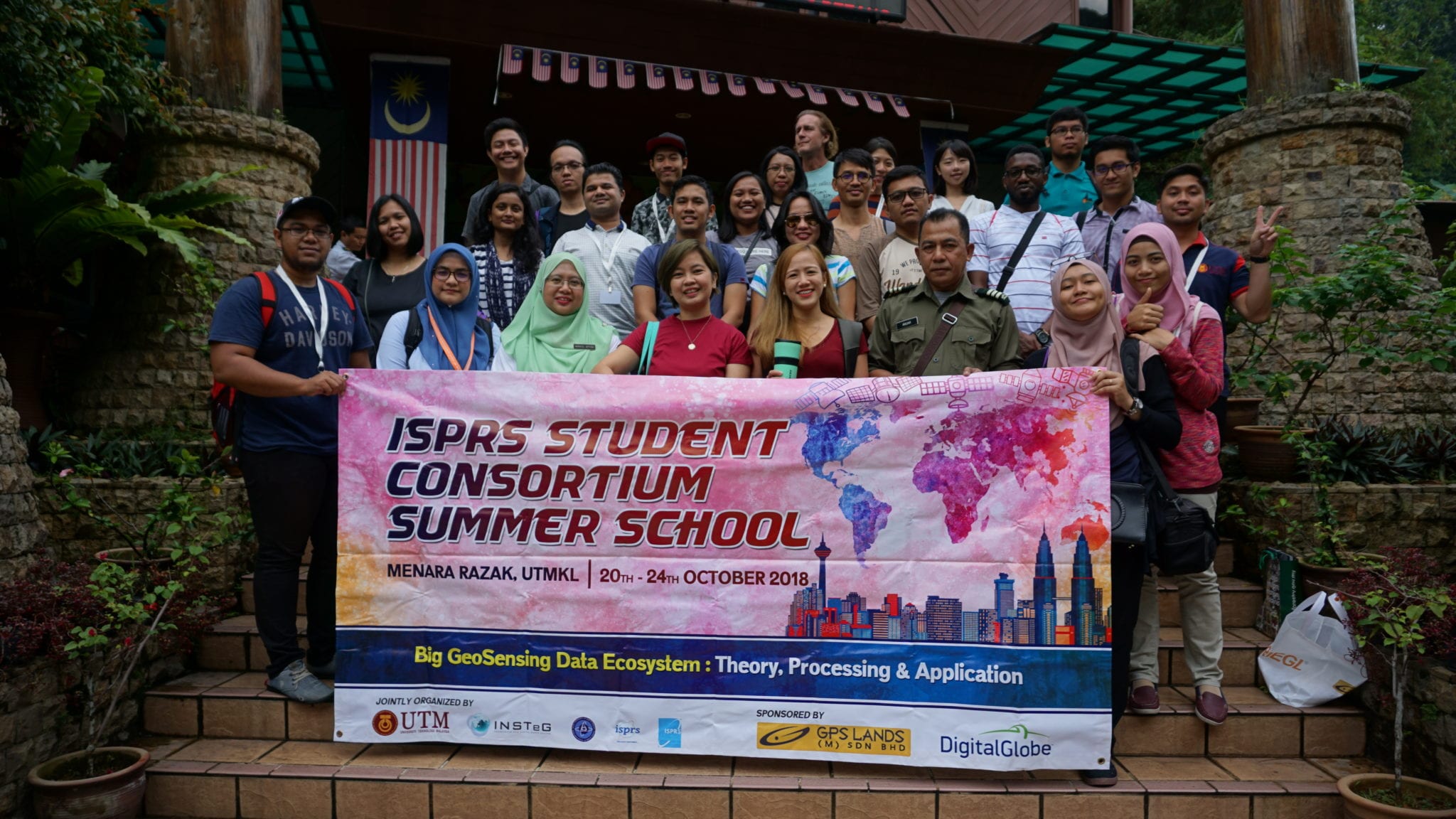
Excursion at KL Forest Eco Park and Kuala Lumpur Tower.